- French
The first stage of the Tour de la Vallée d'Illiez (TVI), Monthey to Morgins, is 13.9 km long with an elevation gain of 1,320 m and takes approximately 5h15 to complete.
The Tour de la Vallée d’Illiez leaves from the regional AOMC train station in the centre of Monthey, to facilitate the use of public transportation. Drivers will find spaces available in the Cotterg car park or in the Place d’Armes car park.
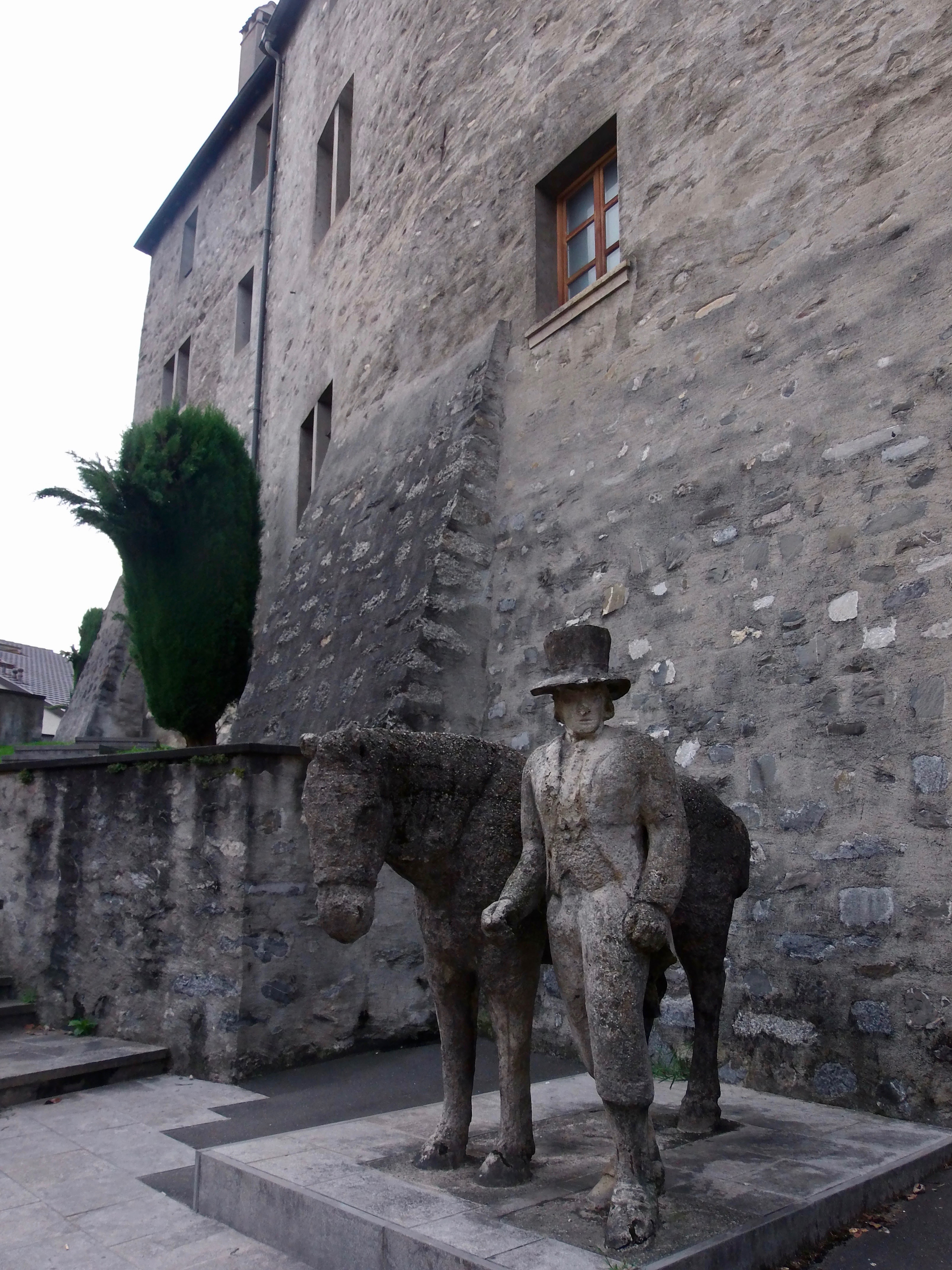
From the train station, walk in the direction of the Place Centrale, then take the Rue du Château. You’ll see the statue of Gros-Bellet, an emblematic historical figure of Monthey and the Illiez Valley. In 1790, he instigated a rebellion which resulted in the departure of the detestable Governor Schiner, at a time when Lower Valais was ruled by the Upper Valais (1798).
From here, the Chemin du Gros-Bellet, which was the original road to the Illiez Valley, begins your first steep climb, getting right into the challenge of this first stage’s significant altitude gain between Monthey (430 m) and Morgins (1,350 m). Athletic hikers can add an additional challenge by passing via the Pointe de Bellevue (2,041 m).
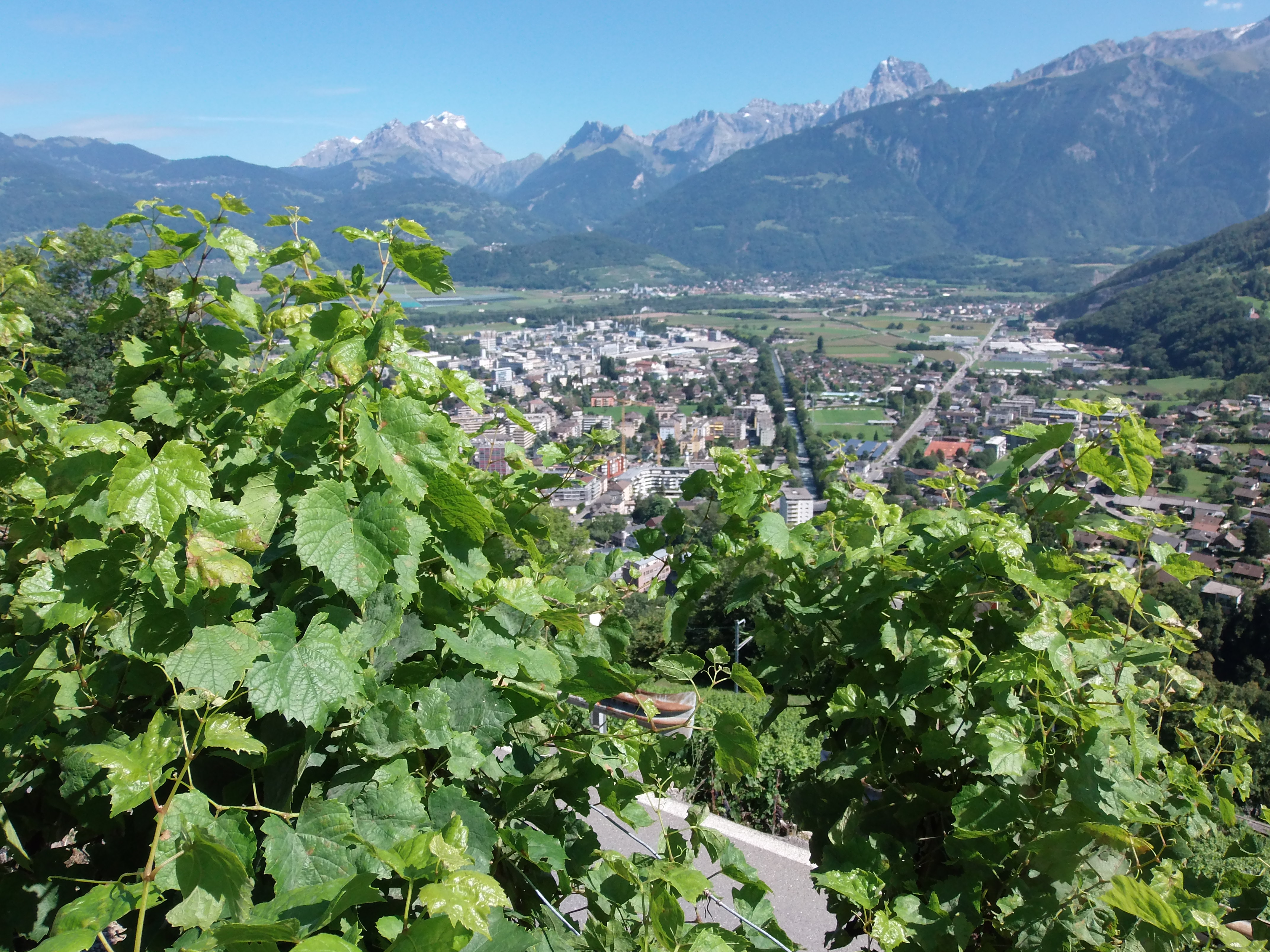
After passing under a pipeline, which conveys water from Troistorrents and Morgins to the hydroelectric plant in Monthey, you will cross the cantonal road in the hamlet of Vers-Ensier and take the Chemin des Ecoliers. From your viewpoint above Monthey, you will see chestnut groves and vineyards, a reminder of Monthey’s importance as a winemaking region before the devastating arrival of Phylloxera at the end of the 19th century.
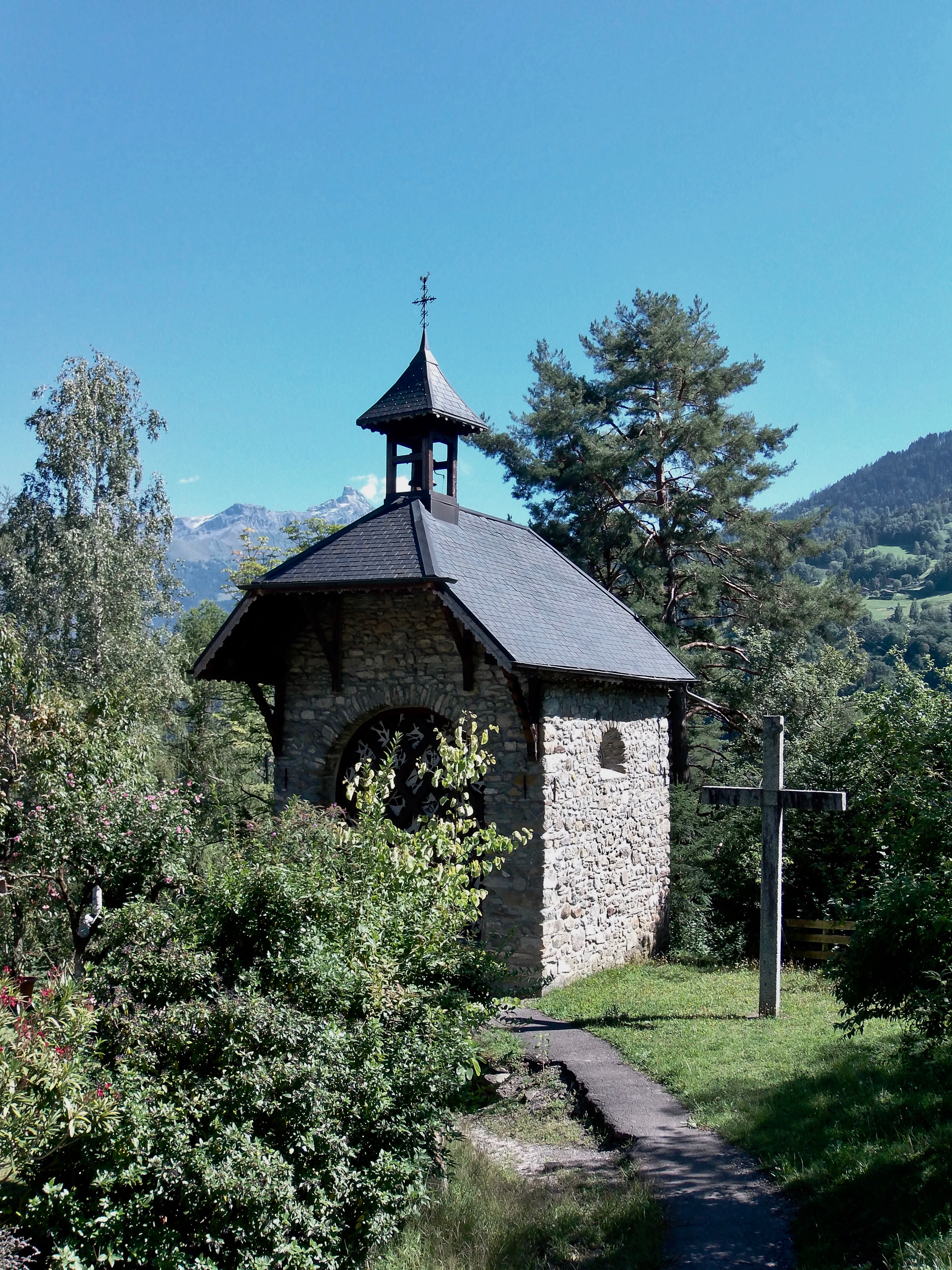
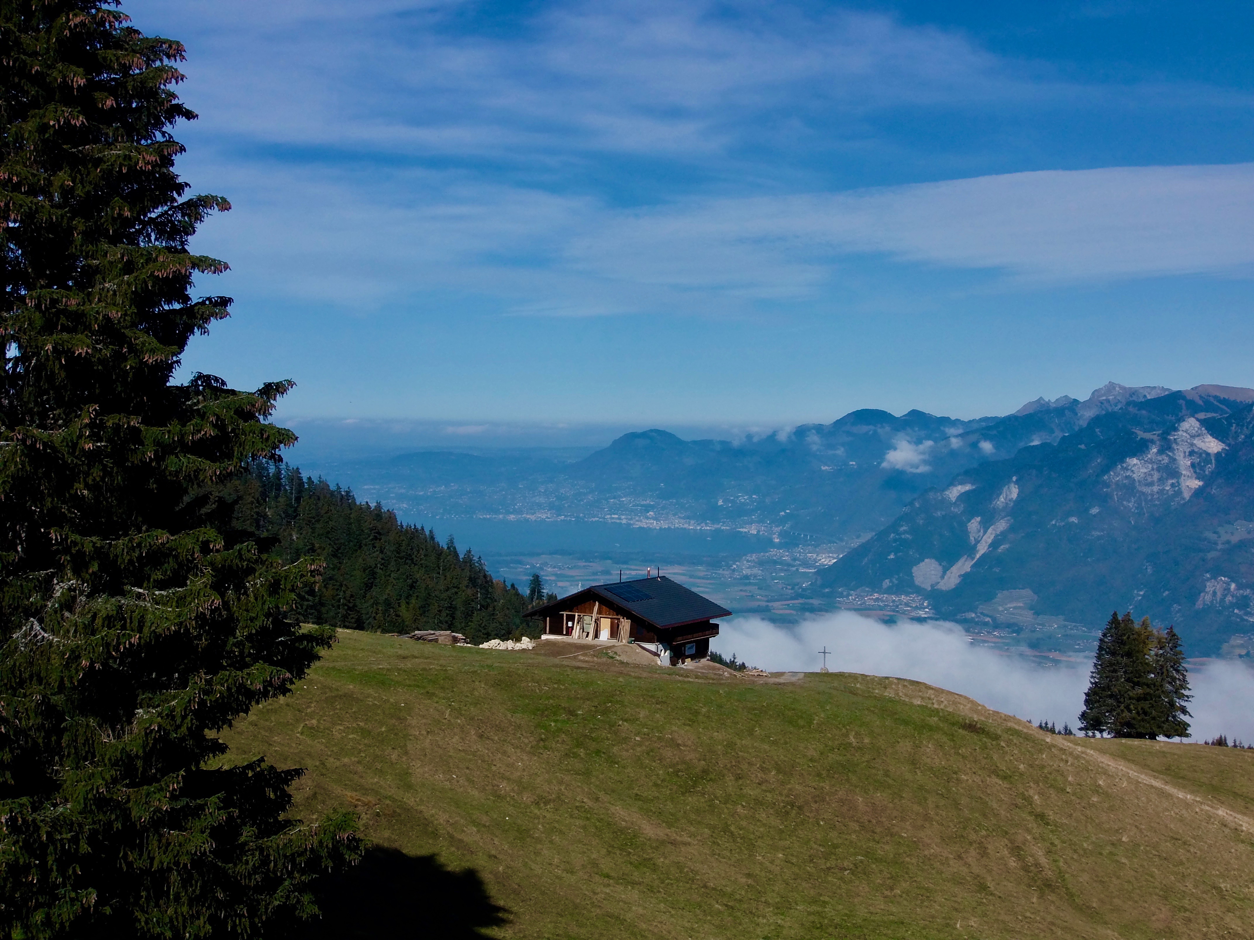
After passing by the tiny Chapel of Chemex, follow the road on the left, which passes under the AOMC railway bridge and leads to the Perraya Cross. From here, cross the road to Propéraz and take the path indicated by the yellow pedestrian sign to the left of the cross to the Route des Revers. Heading in the direction of Gonflon, you will pass through La Crottaz on a steep path. This will lead to Cavos and a sudden surprising viewpoint over the entire Rhône Plain and Lake Geneva.
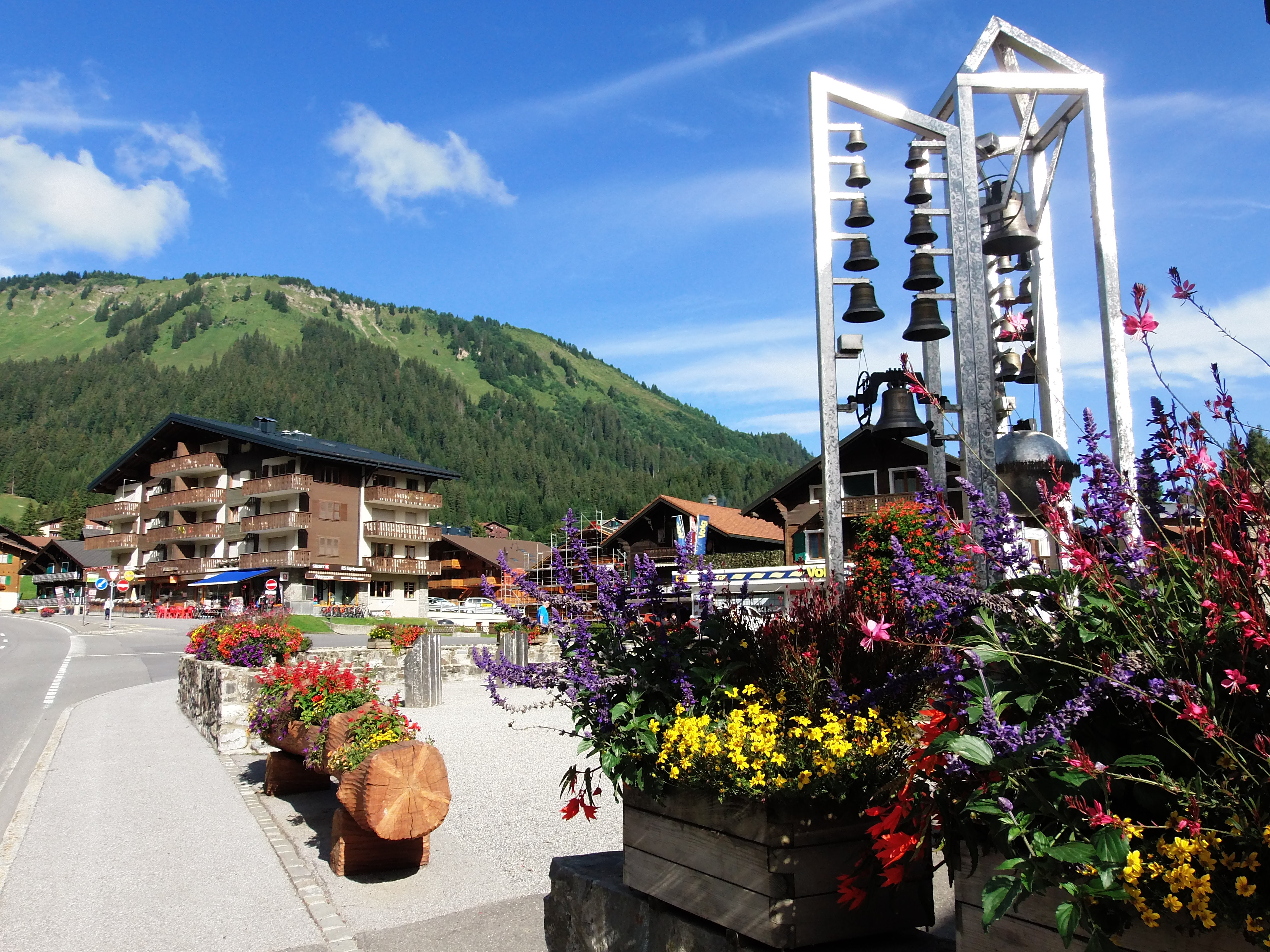
From here, you will arrive in the Chanso and Ferrage regions near Morgins. Continue along the hillside on the Route des Troncs, which crosses the Torrent des Tovares via a covered bridge, then take the Route de Sépaz to Morgins. This is the welcome end to the first stage, with a variety of lodgings, restaurants, and the famous Carillon de la Paix. Built in 2000, with 23 bells outside and 2 in the bell tower, this iconic landmark thrones in the center of Morgins as a beacon of peace for humankind.
Best time of year
Accessibility
Prestations
- Car park
- Pay car park
- Accommodation
- Restaurant